A pair of disturbances, Cyclonic Circulation over SW Arabian Sea and a Trough of Low associated with Easterlies over SW Bay of Bengal, has given a much needed impetus to the NE monsoon dynamics.
Weather Update 04/11/23
Not only in kerala but also north east monsoon at top gear in south Peninsula due to multiple weather system. According to Metbeat Weather, The only Private Weather Firm and website in kerala says Rain activity to continue all south indian states for a week. And another cyclonic circulation and low pressure may form over south west Arabian sea next week says our weatherman.
A pair of disturbances, Cyclonic Circulation over SW Arabian Sea and a Trough of Low associated with Easterlies over SW Bay of Bengal, has given a much needed impetus to the NE monsoon dynamics. Ironically the twin circulations during the 3rd week of October put a spoke to the monsoon dynamics now a twin disturbance, albeit weaker cousins, is bringing back the monsoon dynamics More Rain Expected over Kerala and TN.
Multiple systems enhances NEM
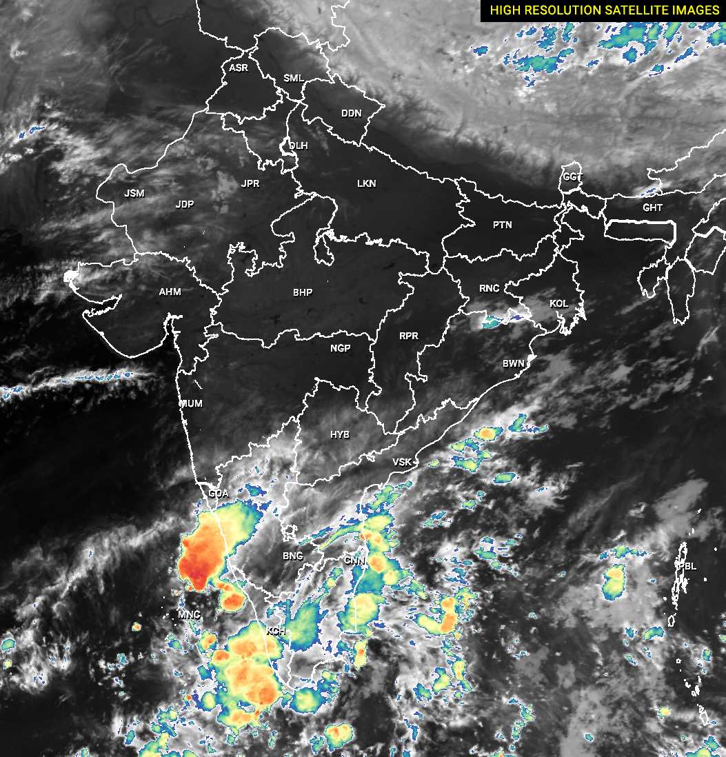
Latest weather observation indicate monsoon dynamic changed and strengthening its activity kerala and Tamil Nadu. Latest satellite images from this (04/11/23) morning shows cloud cover over these states.
Low pressure expected arabian Sea
of rains happening along the coast all the way from South AP to Delta districts. There is a very high chance the cyclonic circulation over SW Arabian Sea could deepen into a Low Pressure Area (LPA) sometime early next week. These few days until it becomes an LPA and moves NW it could bring a lot of moisture incursion over Peninsular India.
Kerala Dams get more water storage
Than sw monsoon season this north east monsoon may gave more water for kerala dams. Sw monsoon not much favourable for dam water storage. But latest weather pattern indicate that dam level will increase due to heavy to very heavy rain in catchment area.
More Rain Ahead Kerala
Expected Arabian Sea LPA moves North West Direction it could bring a lot of moisture incursion over Peninsular India. This could bring some much needed rains to West Interior TN while bringing some heavy to very heavy rains along the Eastern Slopes of Western Ghats. Ironically Northeast Monsoon may bring more rains as a season than Southwest Monsoon this year to parts of Kerala. While one may say it is much needed, it remains to be seen whether these off seasonal rains over some places in Kerala has been a boon or bane.
TN also get Good spell coming days
In the meanwhile closer home the Trough of Low associated with Easterlies is now at a location, Southwest Bay off Sri Lanka, where it could influence rains over large parts of Tamil Nadu. This could potentially mean widespread moderate to heavy rains may happen along the coastal stretch between Chennai and Delta districts. This is likely to continue to for the next couple of days with weekend promising to be the first peak for the coastal areas this Northeast Monsoon Season.
Rain to continue Chennai
Over the past few years we have come to observe both during Southwest Monsoon thunderstorms and during Northeast Monsoon rains there has been an increasing tendency for Rains to intensify as it passes through the coastal stretch of Chennai and suburbs says according to chennairain.com weather experts in TN.
This is likely to be seen during the weekend rains as well. Over the next 24 hours starting from today morning there is a very high chance for many parts of Chennai and suburbs to receive between 50 to 100 mm rains as conditions favor North Coastal Tamil Nadu highly.