‘Rivers in the sky’: what are the atmospheric rivers hitting California?
BY: theguardian.com
California’s wet season is officially underway. The state is grappling with another round of strong storms this week and the dangerous potential for flash flooding, landslides, and furious winds expected to come with them.
Much like last year, when record rainfall lashed the state, the storms are attributed to atmospheric rivers (ARs), systems that have long played a role in California’s precipitation levels – both for good and for bad.
Here’s what you need to know about these weather patterns and the impact they can have across the western US.
What is an atmospheric river?

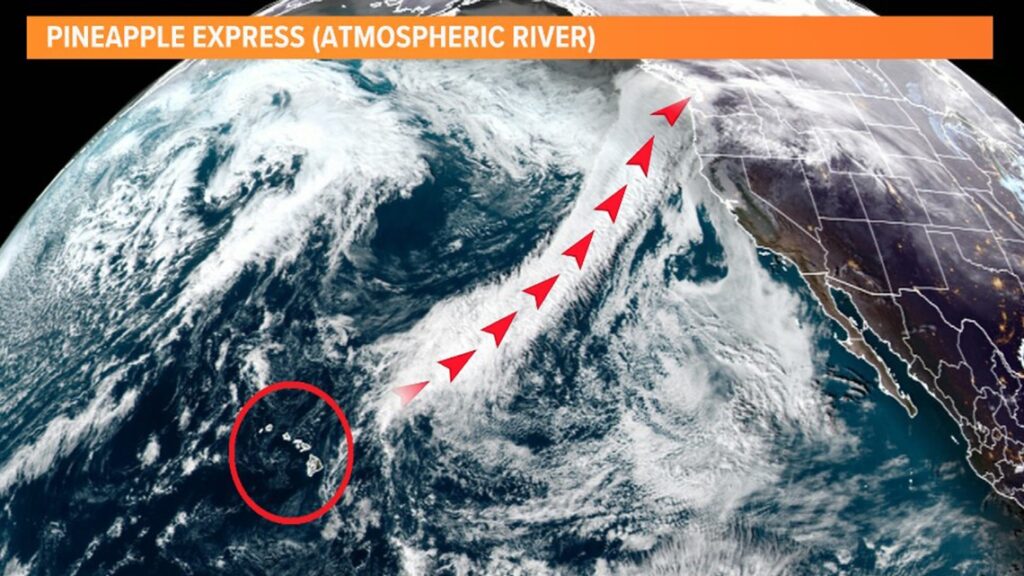
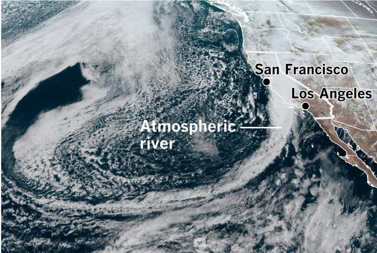
The National Oceanic and Atmospheric Administration refers to these systems as “rivers in the sky” for good reason. Characterized by long streams of moisture in the atmosphere that span between 250-375 miles wide on average, the ARs that impact the US west are supercharged by water vapor that evaporates off the Pacific Ocean and they are carried by other weather systems from the tropics or the subtropics.
The average atmospheric river carries an amount of water vapor that rivals the flow at the mouth of the mighty Mississippi River – and strong ones can hold more than 15 times that amount. That moisture is released as rain or snow when ARs make landfall and, depending on the size, timing and intensity, the storms that result can be highly destructive or extremely beneficial.
ARs are important contributors to California’s water supply, providing up to half of the rainfall and snow that the dry state relies on through the year. But the big ones can also overload rivers and reservoirs, causing damaging floods. The systems also tend to come equipped with strong winds that tear down trees and powerlines, adding to their destructive tendencies.
What is a Pineapple Express?
The storms hitting California this week are part of a “Pineapple Express” system, which is just one kind of atmospheric river. Named for their origin around the Hawaiian Islands, they are often strong systems and have been known to unleash torrents of precipitation when they reach the west coast of the US and Canada. According to the National Ocean Service, they can dump as much as 5in of rain on California in a single day.
This week’s storms have put officials and residents on edge, in part because of their timing. The back-to-back systems are packing a stronger punch together and carry greater potential wreak havoc when systems are already inundated and soils are saturated.
California saw a similar pattern last year when a a series of brutal atmospheric rivers drenched the state, unleashing historic levels of rainfall that caused urban flooding, landslides and road closures. The dangerous conditions caused 22 confirmed fatalities and researchers at Stanford University tallied more than $3bn in losses.
While this winter hasn’t seen that level of rainfall, there have already been instances of severe flooding. Ventura county was hit hard by a deluge late last year that prompted emergency water rescues and left streets submerged. In January, another furious rainstorm washed over San Diego, quickly pushing its aging stormwater systems past capacity. The rising waters rushed into homes and businesses as streets turned to rivers. The event was logged as one of the wettest day’s in the city’s history.
While these storms were incredibly destructive and dangerous and, in some cases, set new records, scientists have warned that they are just a taste of what’s to come. Fueled by the climate crisis, the risks of a catastrophic megaflood – one that could displace millions and generate over $1tn in losses – has doubled in California.

Ahead of this week’s storms, unsubstantiated posts on social media drummed up anxiety that the weather was about to get a lot worse, but researchers and meterologists, including the climate scientist Daniel Swain who co-authored a paper on the troubling scenario, quickly dispelled the misinformation. Still, he cautioned, California has a long way to go to prepare for such an event – and time is running short.
Could the storms have any positive impact?
Despite their potential for damage, ARs are incredibly important in California, and welcomed by water officials still navigating the emergence from prolonged drought. Even with the wet weather, California’s snowpack is lagging this year and there are hopes a heavy dusting could get it closer to historic averages by the end of the wet season in April.
The snowpack is a critical part of California’s water supply, acting as a kind of water savings account for the year ahead, as it slowly melts and flows into streams, soils and reservoirs during drier times of the year. The snowpack provides just under a third of California’s water needs for the year.
The storms are predicted to dump a fresh layer of snow in the mountains, a hopeful sign after February’s snow survey showed the snow in the Sierra Nevada range stands at a meager 52% of average. That was a big bump from the first measurement, done in January, that measured just 28% of average.
Meanwhile, precipitation across the state was 82% of average, officials with the department of water resources reported.
How is the climate crisis playing a role?
California’s climate has long vacillated dramatically from wet to dry, but models show these shifts will occur with increasing intensity as the world warms. ARs are also becoming more likely to arrive in sets, which can cause up to four times more economic damage than each would have individually, according to a study published in Science Advances.
Supercharged by more moisture coming off the Pacific as ocean temperatures rise, scientists expect that ARs could also grow more severe, adding more risks for floods across California and the west. As temperatures rise, precipitation is more likely to fall as rain rather than snow, which could pose problems for the state’s water supply.
