Over 100 inches of rain has fallen on California mountain since November
By Brian Lada, AccuWeather meteorologist and digital journalist
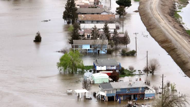
California has been bombarded by atmospheric rivers, bomb cyclones and a few pineapple expresses in recent months making for one of the stormiest winters in recent history. The rainfall total at one weather station in the Southern Coast Ranges reached new heights amid the ongoing storm. Three Peaks, located in the mountains about 100 miles southeast of San Jose, has measured 101.45 inches of rain since Nov. 1, 2022, according to the National Weather Service office in the Bay Area. The weather station on the mountain is at an elevation of 3,362 feet, with the elevation contributing to the extraordinary seasonal rainfall total as higher rainfall amounts are common in the mountains compared to the lower elevations.
For a storm to be dubbed a bomb cyclone, the atmospheric pressure must drop at least 0.71 of an inch of mercury (24 millibars) in 24 hours. Tuesday’s storm blew this benchmark out of the water with a buoy in Monterey Bay, just south of Santa Cruz, recoding a pressure drop of 0.71 of an inch of mercury (24 millibars) in just 17 hours. The storm’s ferocity also generated a storm surge of two feet along the coast of central California. The storm was so intense that it appeared to develop an eye on satellite, similar to what is seen in tropical storms and hurricanes, although this week’s storm was much different than a tropical system.