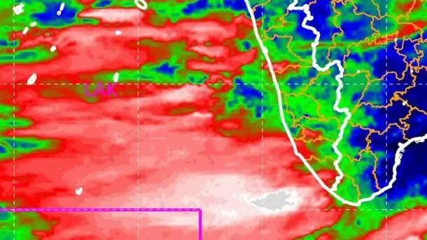
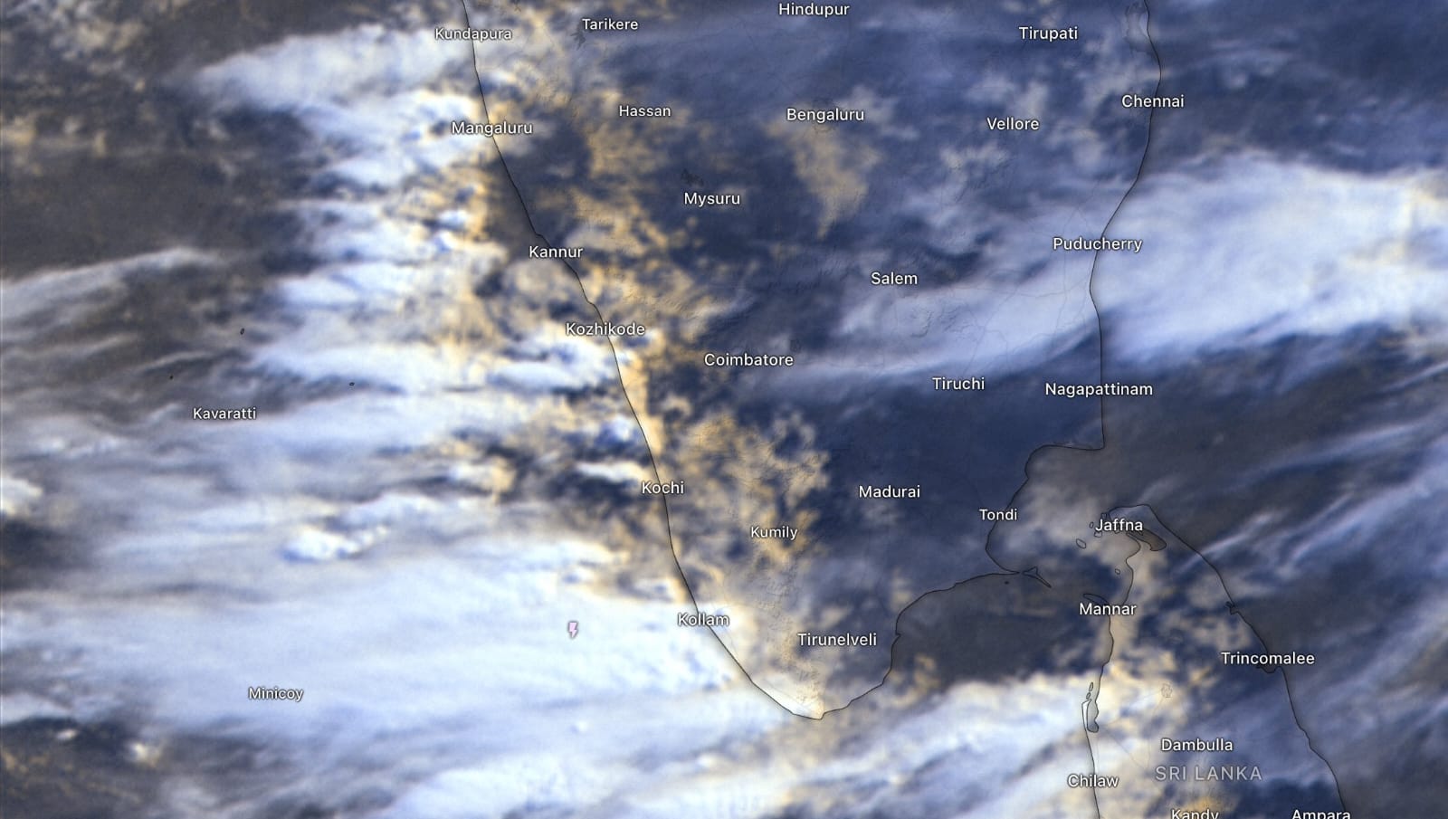
kerala weather (20/06/24): Somali jet reaches Lakshadweep with heavy rain
The Somali jet reached Lakshadweep with heavy rains after crossing the equator and the continents. The Somali jet stream has formed over the Arabian Sea in view of heavy to very heavy rainfall over Kerala from tomorrow (21/06/24). metbeat weather report have indicated that rainfall is likely to intensify in Kerala after The 21st of this month due to the jet stream phenomenon. Let’s take a look at what the Somali jet stream phenomenon is.
Somali jet crossed the equator and the continent, reached as far as Lakshadweep
According to observers at Metbeat Weather, the somali jet stream, which has strengthened in the last 48 hours, is currently having an impact as far as Kavaratti in Lakshadweep. It will also move towards the Kanyakumari Sea. There is a possibility of heavy rains in Thiruvananthapuram and Kollam districts tonight.
At an altitude of 1.5 kmph, the wind speed can reach up to 27 nautical miles per hour. The wind speed is up to 34 nautical miles at this altitude over the Arabian Sea at a distance of 950 km to the west from Kavaratti. The wind speed is up to 49 nautical miles in the Somali Sea at a distance of 1,938 km from Kavaratti.

How many days will it rain?
According to our observers, this phenomenon is likely to bring heavy rains in Kerala for at least five days. The rain will continue until the jet stream strength decreases. Therefore, metbeat advises that things can be sorted accordingly as it is raining heavily for the coming week.
What is Somali Jet Stream?
The Somali jet stream is a wind formed at a low altitude of the atmosphere (1 km to 1.5 km above sea level). This is the range of winds that pass from the southern hemisphere to the northern hemisphere across the equator.
The Somali jet stream, which curves from the east coast of Africa and blows into India, originates during the monsoon. The wind is moving closer to Somalia and is moving towards the western coast, which includes Kerala. That’s why this wind is called the Somali jet stream.
The Somali jet is also blowing along with the southwest monsoon winds. The Somali jet stream originates in the southern hemisphere from Mauritius to the northern part of Madagascar.

Journey from Africa to Kerala
The jet then moves towards the Kenyan coast. The Coast of Kenya is 3 degrees south of the Southern Hemisphere. After entering Kenya, the wind reaches the coasts of Ethiopia and Somalia. This wind will occur in this region in the month of May. This wind will be almost parallel to Thiruvananthapuram along the African coast. The Coast of Somalia is located 9 degrees north of the Northern Hemisphere.
The jet stream then moves towards East Africa. After landing in the Arabian Sea, it will move eastwards along the west coast of India i.e. Kerala in June. The jet stream becomes active when it rains continuously for us.
The jet stream usually strengthens at the end of June or early July. It lasts for 8 to 10 days. Jetstream is a monsoon-strengthening phenomenon in the Indian subcontinent.
The following damages may occur during the rain in the coming days. So the public should be vigilant.
IMPACTS EXPECTED
Water logging on major roads and poor visibility on vehicles may lead to traffic congestion.
Water logging / flooding in many parts of low-lying area and river banks.
Uprooting of trees may cause damages related to the power sector.
Partial damages to houses and huts.
Chances of landslide and landslip.
Rain could cause adverse impact on human & livestock as well as damage to loose & unsecured structures along the coastline
ACTIONS SUGGESTED
Traffic may be regulated effectively
Non essential movements may be restricted and remain at safe places.
FOLLOW US ON
Image Credit: Windy
