A weak western disturbance is likely to bring light isolated rain or snow
Two feeble western disturbances (WDs) were expected to bring light isolated rainfall or snowfall from Thursday to Tuesday to the Western Himalayan region, where many high-altitude areas of Uttarakhand, Jammu and Kashmir, and Himachal Pradesh are yet to record the first snow this season, India Meteorological Department (IMD) said.
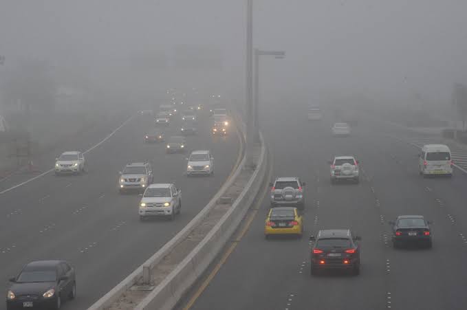
The approaching WDs also helped clear fog enveloping the swathes of India and allowed sunshine during the day on Thursday after smog disrupted air and rail traffic for days this month. The dense fog abated in Rajasthan, the National Capital Region, parts of Punjab, etc. IMD said fog may continue to affect parts of north India for two more days.“There is a change in weather due to approaching WDs and fog has lifted from some areas particularly Delhi, Rajasthan, and the neighbouring areas. But we are not saying that the fog will be cleared completely. We can expect fog for a couple of more days and hence need to be prepared,” said IMD director-general M Mohapatra.
He added precipitation can be expected in the higher reaches of the Western Himalayan region due to the WDs. “If at all… very light rain may be recorded in the northern plains. After the WDs move away, temperatures may drop slightly for a couple of days but they will rise after five to six days in early February,” said Mohapatra.Private weather forecaster Skymet Weather vice president (climate and meteorology) Mahesh Palawat said a gradual end to dense fog was expected. “Both minimum and maximum temperatures are expected to increase marginally, bringing relief from very cold days and nights. After the WDs move away, there will be a minor drop in temperatures but nothing like the past week.”
Strong winds of 120-130 km per hour at 4.5 km above mean sea level over Bangladesh and adjoining Tripura were expected to bring light rainfall to Sub-Himalayan West Bengal and northeast India during the next two days.
Parts of India are experiencing a nearly 100% rain deficiency in January following a deficit in December. The absence of strong WDs has been blamed for a lack of winter precipitation. It also caused cold wave conditions and impacted the Rabi (winter) crop.The unusual weather pattern has been attributed to global warming, Arctic Sea ice melting, or natural variability. The lack of rain and snow has been affecting Himalayan glaciers and water resources in the region
Minimum temperatures were in the range of 3-6°C across plains of Uttarakhand, Punjab, Haryana-Chandigarh-Delhi, parts of Uttar Pradesh, isolated pockets of northwest Rajasthan and Madhya Pradesh. They were 7-10°C in the remaining parts of Rajasthan and Madhya Pradesh, etc.
The temperatures have been below normal by 2-4°C. Kanpur recorded the lowest minimum temperature of 3°C in the region on Thursday.
source: Hindustan Times
