Killer heatwave in north- western India: Monsoon Update
Reghu Ram
The current killer heatwave in the north– western and central regions of north India has claimed more than 10 lives. The unprecedented heatwave has followed a common pattern across the country as the exiting ELNino conditions have left the Indian ocean unusually warm and persistent heat domes and thermal inversion cap brought on by anticyclonic upper air.

The NCR Delhi area has already breached the highest day temperature at 45.6°C while places like Phalodi, Barmer in Rajasthan has already hit 50°C with 1 more month of peak summer remaining. Even the once famed hillstations of Shimla, Nainital and Manali which had been the summer haven have not been spared. Shimla has already crossed 30°C making it even warmer than the coastal cities of Kerala now.
Manali has also hit 29°C, its second ever highest recorded. Similar heatwaves have hot spared the other hill stations of North India making it extremely difficult for the people trapped in the heat.
North Indian heatwave a windfall for Kerala
The north Indian heat wave has come as a great relief for Kerala as the sustained low pressure and heat flux over north west India has in fact created conditions for mid tropospheric lows over Arabian sea and has also quickened the advance of the south monsoon current towards the south western coast.
Has the South Monsoon hit Kerala?
As per my analysis the SWM has already hit Kerala on 28th May for all practical purposes as the main pre-conditions seem to have been met. However the official IMD has a set of parameters to be met before declaring monsoon onset. The Tibetan low and the Tibetan high at 200 hpa sitting on top of the low has already been established.
The north western Indian heat flux has been maintained above 40°C over consecutive days and the upper level westerly subtropical jet has receded north of the Himalayas. The low level monsoon jet has slso been picked up by weather Models upto 850 hpa between 5°N and 65°E at 6-10 knots speed.
Mini cloudbursts to be expected till June 5th
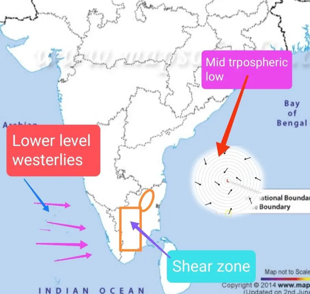
As a mid tropospheric low is likely in the Bay of Bengal around June 1st, with easterly anomalies heavy thundershowers are likely over western and interior Tamil Nadu. This is likely to have a domino effect on the eastern areas of Kerala with the lower level westerlies and upper easterlies on top creating fertile conditions for cloudbursts.
Currently a mid tropospheric low is over Lakshadweep and another one in south east Srilanka triggering incessant rains over coastal south Kerala.
To Join Our groups
