Kerala Fisheries University of Marine Studies finds 13% of areas in Kerala vulnerable to landslides.
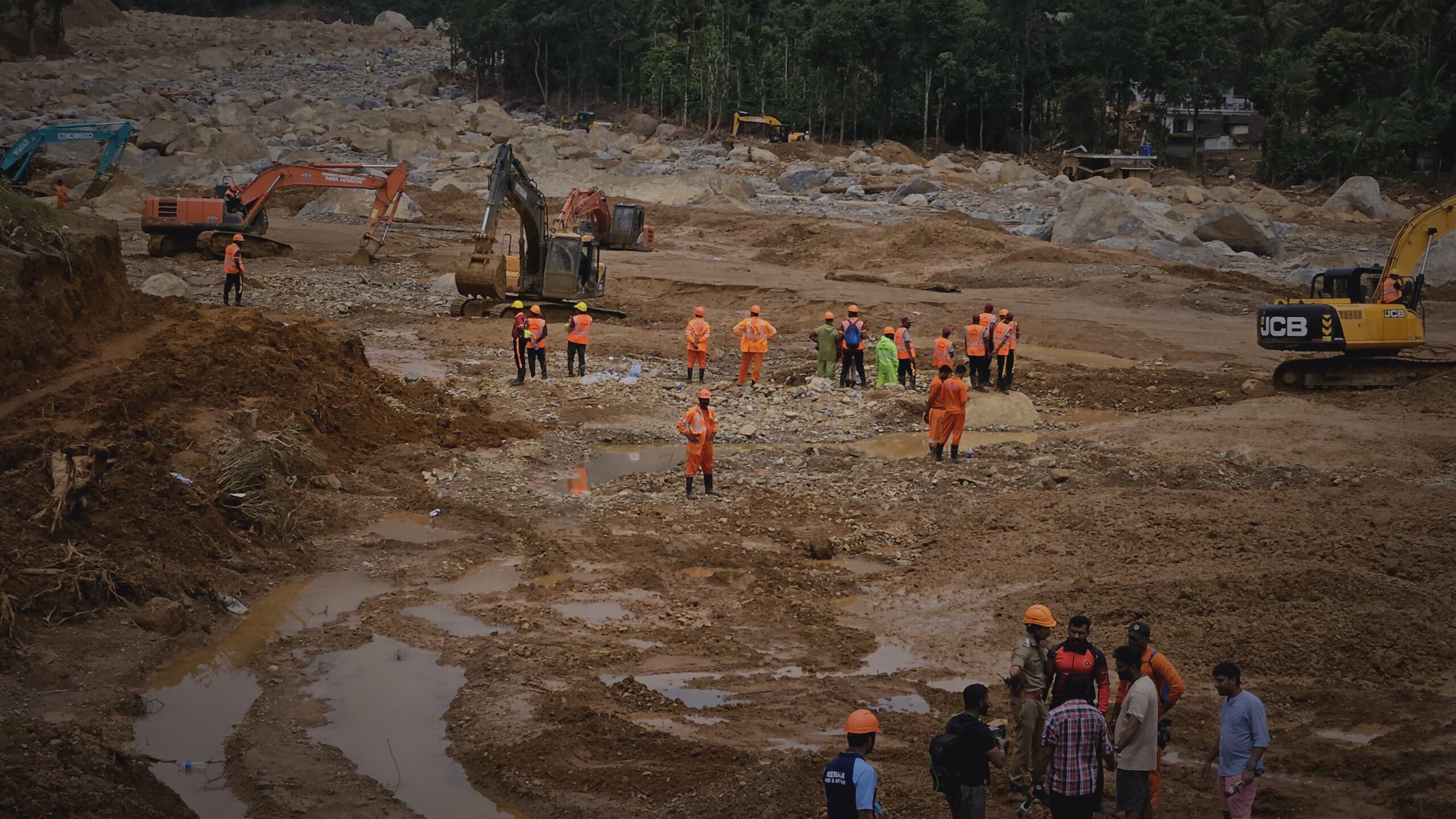
A recent study by the Kerala Fisheries University of Marine Studies reveals that 13% of areas in Kerala are prone to landslides. The research, conducted with the aid of AI and satellite imagery, has resulted in a hazard warning map that identifies high-risk regions. The districts most vulnerable to landslides are Idukki, Pathanamthitta, Palakkad, Malappuram, and Wayanad.
According to the study, the primary cause of landslides is intense rainfall in a short span. Compared to previous years, the risk of landslides in these districts has increased by 4%. The Landslide Probability Map, created using AI and satellite images, highlights the current danger zones, with Wayanad’s Mundakai and Churalmala areas identified as hotspots.
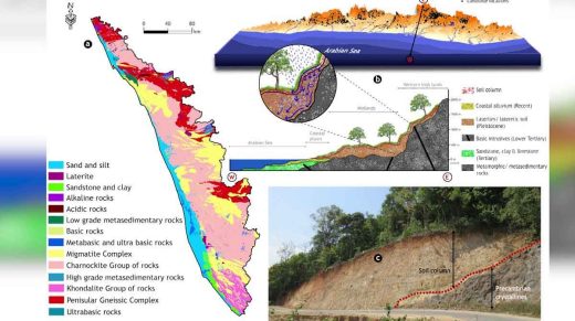
The research, led by Dr. Girish Gopinath and AL Achu of Kufos, was released in January and warned of the potential for accidents in these areas. The study’s findings aim to inform and mitigate the risks associated with landslides in Kerala.
കാലാവസ്ഥ അപ്ഡേറ്റായിരിക്കാന് താഴെ കൊടുത്ത ഞങ്ങളുടെ ഗ്രൂപ്പുകളില് ചേരാം.
വാട്സ്ആപ്
ടെലഗ്രാം
വാട്സ്ആപ്പ് ചാനല്
Google News
Facebook Page
Weatherman Kerala Fb Pag